
Walk a Tulsa County Street
Begin with one complete address, not a broad name search. The Assessor Property Search is Tulsa County's practical first stop because one field accepts an address, account number, subdivision, or owner. Use a short standard address and choose the right parcel from the results. The property card supplies the situs address, owner name, tax mailing address, account number, parcel ID, and legal description. That combination narrows a street number to a particular piece of land. It does not certify title or identify everyone at the address.
- Enter the address in the Assessor search. Use less text if a full entry does not return a result, and avoid punctuation that can block a match.
- Save the parcel ID and legal description from the selected card. For platted land, note the subdivision, lot, and block. For unplatted land, preserve the section, township, and range wording.
- Use the parcel or legal description in County Clerk Acclaim. Limit the result set with a document type and recording-date range when either is known.
- Read the acquiring instrument, then compare grantor, grantee, recording date, and legal description before following an earlier transfer.
- Do not enter a street in the OK Voter Portal. It requires a registered name and date of birth; use voter data only through the correct authorized channel.
- For a past address, ask the Library Research Center about a reverse or criss-cross directory for the relevant year. That address-to-name format is historical and is not confirmed for every year.
That order keeps the street directory grounded in the actual parcel. It also separates an owner record from evidence that a person was present at an address during a particular period.
Search Tulsa County Street Records
The Assessor advises that less is more. A street search can start with a house number and street name, then use the filters displayed below the result columns. Quotation marks make an exact phrase, while a leading minus sign excludes a term. The field accepts an owner name, account number, subdivision, or address, so it is not a dedicated street-browse tool. Still, its result filters make it the documented county entry point for checking several parcels on the same street.
| Assessor field or control | Documented use |
|---|---|
| Address, account, subdivision, or owner | Required free-text query. It accepts an address, an account number, a subdivision, or an owner string. |
| All | Displayed result-scope selector. The portal did not expose its full alternative list in the inspected text. |
| Column filters | Available after results to narrow a broad response. |
| Exact phrase and exclusion syntax | Quotation marks require exact terms; a minus sign removes a term or quoted phrase. |
| Clear and Search | Clear removes the query; Search runs the property query. |
A sample Assessor parcel card shows the separate situs and mailing fields available after a match.
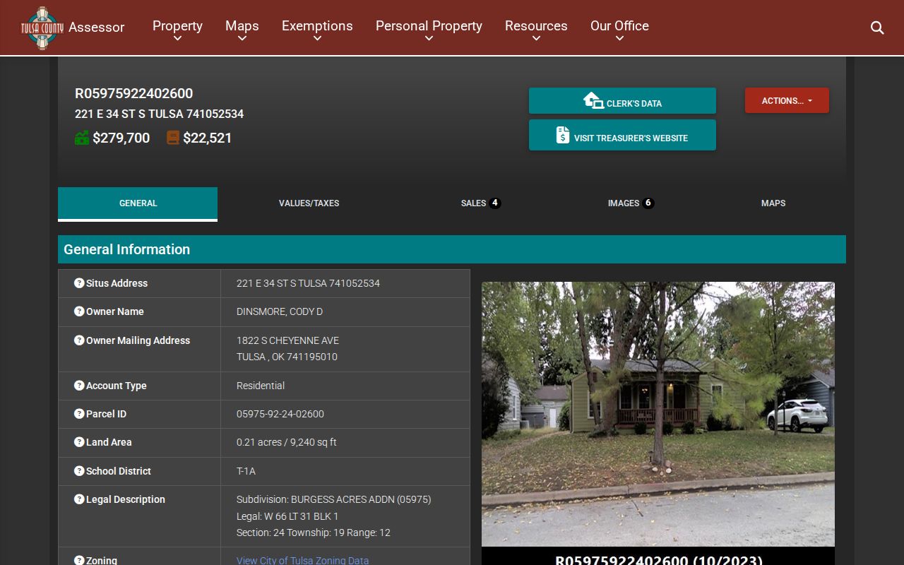
The card's mailing field is where tax correspondence goes. It can differ from the situs, which is the physical location of the parcel, and that difference does not identify a current household.
Read Tulsa County Parcel Fields
Property cards provide a useful field set, but each field has a narrow meaning. The tax-year improvements table can show year built, living area, stories, roof, foundation, exterior, HVAC, and related assessment characteristics. Its year-built value is not a deed date or a guarantee of construction completion. The Assessor calls its ownership information informational, and the County Clerk remains the legal repository for ownership records.
- Parcel
- A defined tract tied to an account or parcel ID.
- Situs address
- The physical location of that land.
- Plat
- A record that lays out lots and blocks in a subdivision.
- Criss-cross directory
- A historical directory arranged from address to name rather than from name to address.
Owner mailing address, school district, land area, legal description, subdivision, and zoning links can help distinguish similar street numbers. None is a household roster. The public card does not list other occupants, utility accounts, a deed image, sale price, or a complete title chain.
Map a Tulsa County Street
Map work provides physical context for a street directory search. Tulsa View, the Assessor mapping product described by Tulsa City-County Library, is available on Research Center PCs RS017C and RS029C. It can display land plots, dimensions, zoning codes, subdivision boundaries, unplatted land, physical characteristics, and owner data based on annual assessor rolls. County Highway Engineering also provides an official GIS entry point.
Tulsa County Engineering GIS is the county's documented map route.
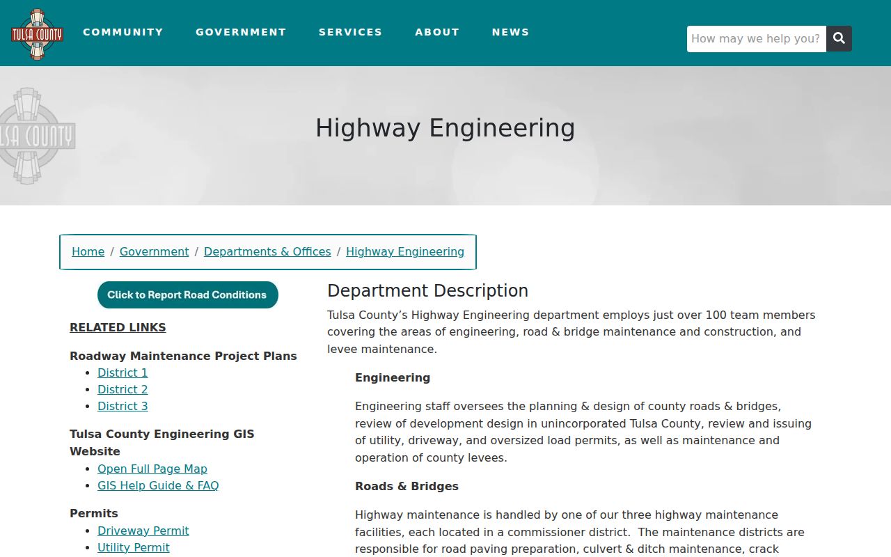
The research did not document a public radius tool or a complete parcel-viewer field list. Browse around the subject parcel, open selected records one at a time, and compare parcel IDs and legal descriptions rather than treating a map as a resident list.
Maps are especially helpful where a Tulsa street crosses a subdivision line or gives way to an unplatted parcel. The graphical view can show the lot pattern behind a familiar street form, while the Assessor record supplies the account and the County Clerk record supplies the recorded-land trail. Keep those functions separate when a map label and a legal description use different wording.
Trace Tulsa County Street Deeds
Acclaim is the County Clerk's recorded-land route. Its parcel search calls for a legal parcel number, such as the format shown in its help, and offers Starts With, Contains, and Exact matching. Document type and date controls can narrow the list. The landing page also displays a verified-through date and instrument number, so a later search should be described as a dated index result, not an up-to-the-minute title statement.
County documentation places the online legal-description index from 1987 to current and the name index from 1928 to current. The web service is fee-based and registered. Historical Camera Record Images, older books, or the Clerk counter are the appropriate next channels when a transfer predates the available web index. Recording and copy fees do not promise that every historic instrument is digitized.
Acclaim's parcel and legal-description search displays the documented document and date controls.
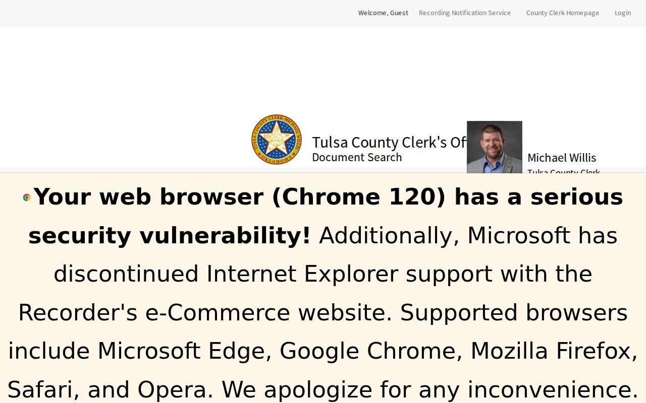
Move from the Assessor's street address to this legal-description search. A street address alone is not the permanent key for a deed chain and may be reformatted over time.
Check Tulsa County Street Permits
City Development Services adds a property-history layer for addresses inside its jurisdiction. Its CSS guest search documents type, address, and date search modes. Use the city's normalized pattern, with abbreviated directions and no punctuation, when testing an address. A permit result can place regulated work, status, and releasable supporting documents at a property. It does not establish a complete history of people at the address.
The City's guest permit-search guidance shows the documented address format and search options.
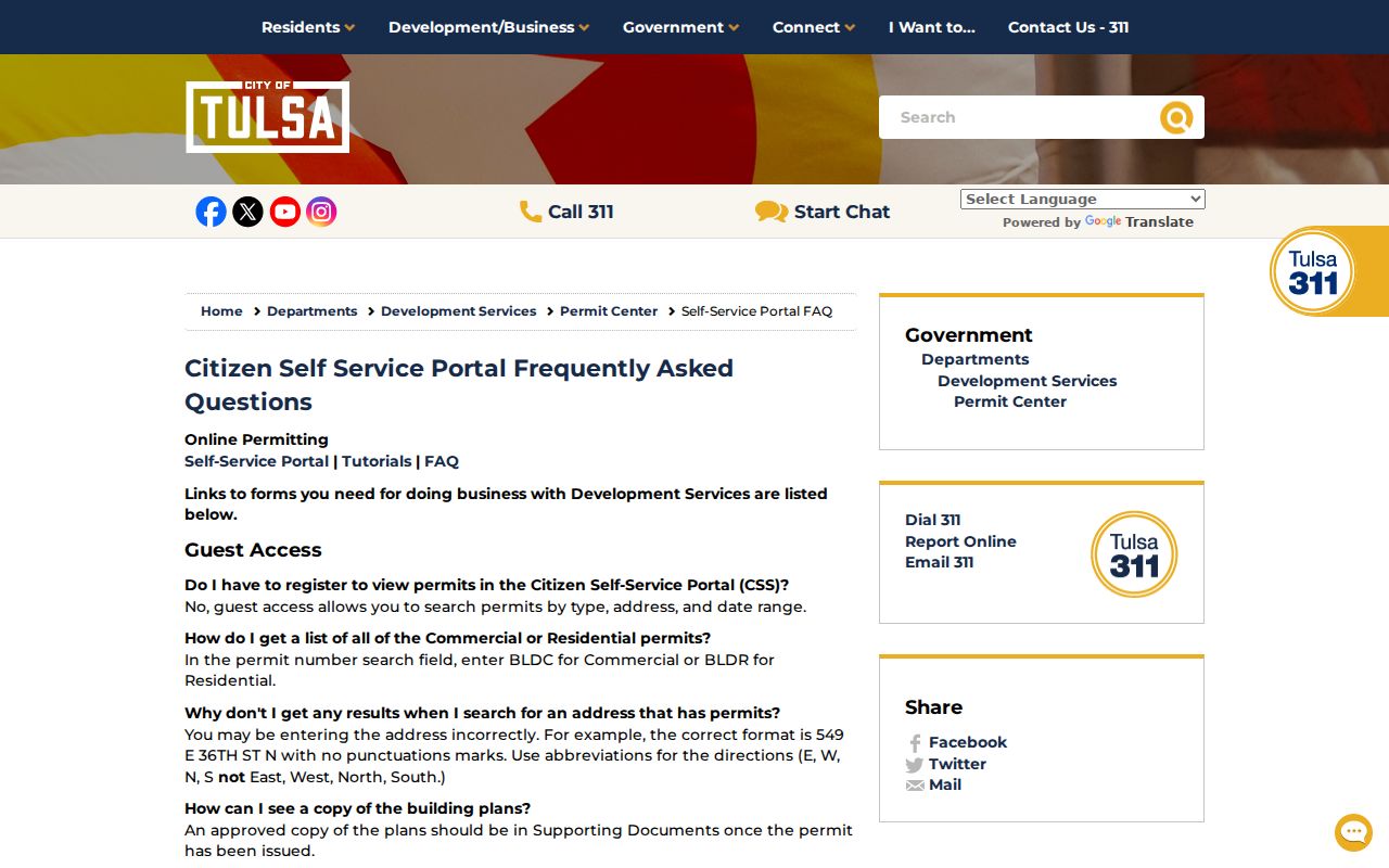
Permit and code records are best read as civic and construction context. They should not be converted into claims about current household composition.
Tulsa County Address Record Coverage
Address-keyed sources overlap, but they do not say the same thing. The record chain below makes the handoff clear: use the Assessor for a current parcel lead, the Clerk for recorded transfers, a permit portal for work history, and library material for dated historical address context.
| Source | Starting input | Useful result | Important limit |
|---|---|---|---|
| County Assessor | Address, owner, account, or subdivision | Situs, owner, mailing address, parcel, legal description, and annual assessment context | Not legal title certainty or a complete occupant list |
| Tulsa View | Parcel or map browse | Plots, dimensions, zoning, subdivisions, and owner context | No documented public all-neighbor export |
| County Clerk Acclaim | Parcel or legal description, then document/date | Grantor, grantee, recording context, and legal transfer trail | Not a street-address resident roll; web coverage has historic cutoffs |
| City CSS permits | Permit type, address, and date | Permit, project, status, and releasable documents | Not a list of past or current occupants |
| City directories | Name or available reverse address entry | Historical address, occupation, and spouse context | Not continuous proof of occupancy |
The account and legal description are the durable bridge between these sources. Street spelling is still useful, but old directories, plats, and property systems can render it differently.
Use Tulsa County Street Grid
Tulsa's central grid helps normalize an address before searching. Admiral Boulevard divides the numbered east-west street pattern: First Street begins just south of it, then Second Street follows, with Places and Courts filling some gaps. North of Admiral, historical street names run alphabetically before 26th Street North. Subdivisions and outlying county communities can vary from this pattern, so it is an orientation tool rather than a countywide rule.
Preserve the source spelling when working with older records. A directory may write a direction in full, the Assessor may abbreviate it, and a deed may rely only on a legal description. The original townsite street grid dates to 1901, which is another reason older wording should not be silently modernized.
Find Tulsa County Street Entries
For a past address, Central Library city directories begin in 1909. A standard volume can supply a name, address, occupation, or spouse detail for its publication year. A reverse or criss-cross volume, when available, reverses the path from address to name. Exact reverse-directory years were not confirmed in the research, so contact the Research Center before expecting a particular street to be searchable that way.
Pair a directory entry with a dated deed, the parcel's legal description, or the released census record that fits the period. The fuller historical collections belong with the Tulsa County city directories, while the street directory remains focused on fitting an address to the correct parcel and time.
Street history has its own local trap. The original townsite grid dates to 1901, while later records may use abbreviated directions, subdivision names, or a legal description with no street at all. Save the address as printed in the historical source and compare it with the normalized search form. A spelling change or missing direction can otherwise look like a move.
Tulsa County Street Voter Limits
Oklahoma's OK Voter Portal is not a public street roster. It requires the person's name as registered and date of birth for individual verification. The portal can show a registrant's own status, districts, polling place, sample ballot, and address-change options. It does not accept a street to return a list of voters.
Full Election Data Warehouse access follows a separate eligibility and attestation process. It omits phone numbers, email addresses, Social Security numbers, driver-license information, and protected address data. Restricted Records and Address Confidentiality Program participants receive additional protection. A no-match can reflect a formatting issue, a move, an update, or a privacy program, not proof that someone was never present.
Limits of a Tulsa County Street Directory
No official source inspected produces a public list of everyone living on a Tulsa County street. Property records describe an owner and tax-mail destination. Historical directories are compilations with gaps. Voter information has access rules and protected records. Renters, relatives, roommates, and people who are not registered voters are not comprehensively indexed through a public street search. Federal law also restricts personal address information in motor-vehicle records, and no public utility-customer list was located.
Lawful personal research. Use address and parcel records carefully and confirm consequential facts with the record custodian. Oklahoma privacy programs withhold protected addresses, and no record should be used to stalk, harass, intimidate, or harm another person.
When the online result is incomplete, request only existing records from the office that holds them. The Oklahoma Open Records Act allows prompt, reasonable access while permitting procedures and direct costs that protect records and avoid excessive disruption.